Reading the live feed from Caltrans...

Reading the live feed from Caltrans...
The Eastern Sierra's main street: two high summits, Mono Lake, the Mammoth Lakes turnoff, and the Sherwin Grade, with no parallel route anywhere along it.
US-395: Carson City to Bishop is open. No chain controls are in effect on this stretch right now.
Nevada State Line · Topaz · 5,049 ft
No chain controls are in effect at this time.
Coleville / 8 Mi. S of Nevada State Line · Coleville · 5,131 ft
No chain controls are in effect at this time.
Walker / 14 Mi. S of Nevada State Line · Coleville · 5,459 ft
No chain controls are in effect at this time.
China Gardens / 17 Mi. S of Nevada State Line · Coleville · 5,780 ft
No chain controls are in effect at this time.
Walker Cyn. / 20 Mi. S of Nevada State Line · Coleville · 6,181 ft
No chain controls are in effect at this time.
Sonora MTCE Stn. / 26 Mi. S of Nevada State Line · Coleville · 6,866 ft
No chain controls are in effect at this time.
Burcham Flat Rd / 3 Mi. S of Jct. 108 · Bridgeport · 7,214 ft
No chain controls are in effect at this time.
Jct. 108 / 26 Mi. S of Nevada State Line · Bridgeport · 6,925 ft
No chain controls are in effect at this time.
Rattlesnake / 8 Mi. N of Bridgeport · Bridgeport · 7,201 ft
No chain controls are in effect at this time.
Buckeye Rd. / 3 Mi. N of Bridgeport · Bridgeport · 6,551 ft
No chain controls are in effect at this time.
North End of Bridgeport · Bridgeport · 6,476 ft
No chain controls are in effect at this time.
1.5 Mi. S of Bridgeport · Bridgeport · 6,496 ft
No chain controls are in effect at this time.
Jct. 270 / Bodie Rd. · Bridgeport · 6,870 ft
No chain controls are in effect at this time.
Bodie Flats / 8 Mi. S of Bridgeport · Bridgeport · 7,316 ft
No chain controls are in effect at this time.
11 Mi. S of Bridgeport / 1 Mi. N of Conway Summit · Lee Vining · 7,900 ft
No chain controls are in effect at this time.
10 Mi. N of Lee Vining / 16 Mi. S of Bridgeport · Lee Vining · 7,463 ft
No chain controls are in effect at this time.
Foot of Conway / 8 Mi. N of Lee Vining · Lee Vining · 6,971 ft
No chain controls are in effect at this time.
Jct. 167 / Pole Line Rd. · Lee Vining · 6,906 ft
No chain controls are in effect at this time.
Mono Lake / 2 Mi. N of Lee Vining · Lee Vining · 6,522 ft
No chain controls are in effect at this time.
Lee Vining / JNO High School · Lee Vining · 6,748 ft
No chain controls are in effect at this time.
Lee Vining City Limits · Lee Vining · 6,814 ft
No chain controls are in effect at this time.
7 Mi. S of Lee Vining · June Lake · 7,066 ft
No chain controls are in effect at this time.
Sand House / 8 Mi. S of Lee Vining · June Lake · 7,329 ft
No chain controls are in effect at this time.
S Jct. 158 · June Lake · 7,696 ft
No chain controls are in effect at this time.
S Jct. 158 · June Lake · 7,719 ft
No chain controls are in effect at this time.
Hartly Springs / 2 Mi. S of S Jct. 158 · June Lake · 7,910 ft
No chain controls are in effect at this time.
Crestview MTCE Stn. / 6 Mi. S of S Jct. 158 · Mammoth Lakes · 7,513 ft
No chain controls are in effect at this time.
Crestview MTCE Stn. / 8 Mi. N of Jct. 203 · Mammoth Lakes · 7,519 ft
No chain controls are in effect at this time.
Scenic Loop Rd. / 4.5 Mi. N of Jct. 203 · Mammoth Lakes · 7,572 ft
No chain controls are in effect at this time.
Scenic Loop Rc. / 4.5 Mi. N of Jct. 203 · Mammoth Lakes · 7,578 ft
No chain controls are in effect at this time.
S End of Trees / 1 Mi. N of 203 · Mammoth Lakes · 7,319 ft
No chain controls are in effect at this time.
Jct. 203 / Mammoth Off-Ramp · Mammoth Lakes · 7,290 ft
No chain controls are in effect at this time.
Sherwin Crk. Rd. / 1 Mi. S of Jct. 203 · Mammoth Lakes · 7,188 ft
No chain controls are in effect at this time.
Benton Crossing Rd. / 6 Mi. S of Jct. 203 · Mammoth Lakes · 7,063 ft
No chain controls are in effect at this time.
Crowley Lake O.P. / 28 Mi. N of Bishop · Mammoth Lakes · 6,873 ft
No chain controls are in effect at this time.
Crowley Lake O.P / 12 Mi. S of Jct. 203 · Mammoth Lakes · 6,863 ft
No chain controls are in effect at this time.
Toms Place / 25 Mi. N of Bishop · Mammoth Lakes · 7,040 ft
No chain controls are in effect at this time.
Rock Crk Rd / 15 Mi. S of Jct. 203 · Mammoth Lakes · 7,017 ft
No chain controls are in effect at this time.
Windmill / 20 Mi. N of Bishop · Swall Meadows · 6,853 ft
No chain controls are in effect at this time.
Sandshed / 17 Mi. N of Bishop · Bishop · 5,823 ft
No chain controls are in effect at this time.
16 Mi. N of Bishop · Bishop · 5,511 ft
No chain controls are in effect at this time.
Foot of Sherwin Grade / Gorge Rd. · Bishop · 4,517 ft
No chain controls are in effect at this time.
0.2 Mi. S of Pine Creek Rd. · Bishop · 4,520 ft
No chain controls are in effect at this time.
Bishop Wye Rd. / N End of Bishop · Bishop · 4,173 ft
No chain controls are in effect at this time.
3 Mi. N of Bishop / Gun Club · Bishop · 4,291 ft
No chain controls are in effect at this time.
S End of Bishop / D09 District Office · Bishop · 4,150 ft
No chain controls are in effect at this time.
Every Caltrans chain checkpoint on this stretch, in the order you will meet them. The level is read from Caltrans's own posting for that checkpoint. What R-1, R-2, and R-3 require is on the chain guide.
US 395 At Topaz
SR 98 - CLOSED
SR 108 - CLOSED\\
SR 120 - CLOSED\\
US 395 At Bridgeport
SR 120 - CLOSED
Message sign near Bridgeport
SR 108 - CLOSED\\
SR 89 - CLOSED
US 395 NB Lee Vining
SR 120 - CLOSED\\
SR 108 - CLOSED\\
SR 89 - CLOSED
US 395 NB Crowley Lake
SR 120 - CLOSED\\
SR 108 - CLOSED\\
SR 89 - CLOSED
US 395 At Bishop
SR 120 - CLOSED\\
SR 108 - CLOSED\\
SR 89 - CLOSED
Lane Closure
2 of 4 lanes closed at Virginia Lakes Road, northbound, for drainage work.
Lane Closure
Traffic Break at Virginia Lakes Road, southbound, for utility work.
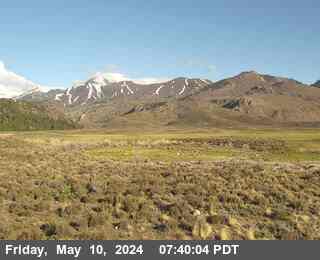
Coleville · 6,902 ft · Caltrans still image

Bridgeport · 6,486 ft · Caltrans still image
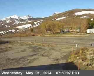
Lee Vining · 8,149 ft · Caltrans still image
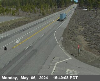
June Lake · 8,031 ft · Caltrans still image
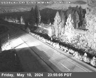
Mammoth Lakes · 7,529 ft · Caltrans still image
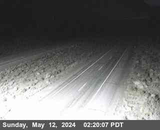
Mammoth Lakes · 6,906 ft · Caltrans still image
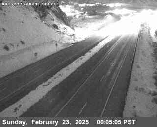
Lake Crowley Exit Ramp · 6,886 ft · Caltrans still image
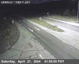
Mammoth Lakes · 7,037 ft · Caltrans still image
Bridgeport
Now: Partly Sunny, 56°F, wind 0 to 10 mph S.
Tonight: Partly Cloudy then Slight Chance Light Snow, 16°F.
Mammoth Lakes turnoff
Now: Mostly Sunny, 47°F, wind 5 to 10 mph SW.
Tonight: Partly Cloudy, 25°F.
Bishop
Now: Mostly Sunny, 66°F, wind 2 to 13 mph SSE.
Tonight: Mostly Cloudy, 32°F.
Forecasts: National Weather Service, for each point itself.
US-395 south of Carson City is the Eastern Sierra's main street, roughly 140 miles of highway from the Carson Valley to Bishop. It leaves the valley floor at Minden and Gardnerville, crosses into California at Topaz Lake, follows the West Walker River, climbs Conway Summit and Deadman Summit, passes Mono Lake and the Mammoth Lakes turnoff, and drops the Sherwin Grade into the Owens Valley. The live data on this site is Caltrans District 9 data, which begins at the California state line north of Topaz Lake and runs to Bishop.
For the Nevada half of the drive, Reno to Carson City through Washoe Valley, the live status, wind restrictions, and cameras are on the US-395 Reno to Carson City page on i80pass.com. This site picks the corridor up at the state line and carries it south.
Southbound from Carson City, US-395 runs the length of the Carson Valley through Minden and Gardnerville, with the Sierra front rising straight off the valley floor to the west and ranch country spreading east. It is an easy, scenic half hour that fools people: the valley can be calm and dry while Conway Summit, an hour ahead, is in a full chain control. At the south end of the valley the road passes Topaz Lake and crosses the California state line, where this site's Caltrans coverage begins, then enters Antelope Valley and the towns of Coleville and Walker.
Past Walker the highway narrows and follows the West Walker River through its canyon, one of the prettiest and twitchiest stretches on the corridor. The canyon holds shade late into the morning, so ice lingers on the pavement after the open valley has dried, and its rock walls shed debris after storms and freeze thaw cycles. In summer the same stretch stacks up with RVs and trailers headed for the campgrounds. Give it your full attention in both seasons.
The road climbs out of the canyon to the junction with SR-108, the Sonora Pass road, which closes for the winter and usually reopens in late spring. Beyond it lies the Bridgeport Valley, a broad, high ranching basin with Bridgeport, the Mono County seat, at its south end. The SR-270 turnoff leads to the ghost town of Bodie. Bridgeport is the last full services stop before Lee Vining, and on storm days it is where southbound traffic stacks up waiting for Conway Summit controls to lift.
South of Bridgeport the highway climbs in earnest to Conway Summit at 8,138 feet, the highest point on this corridor and one of the highest points on US-395 anywhere. The summit overlook above Mono Lake is one of the great roadside views in California, and the grade on both sides is exposed to the full force of Sierra storms. Conway is usually the first place on the corridor to see chain controls and the last to lose them. If the live status on this page shows a restriction anywhere between Bridgeport and Lee Vining, plan on it being worst at the top.
The descent winds down to Lee Vining on the west shore of Mono Lake, where SR-120 turns west toward Tioga Pass and Yosemite in the summer season. Lee Vining has fuel, food, and lodging, and it is the natural regrouping point before the next climb.
South of Lee Vining the road climbs again past the south junction of SR-158, the June Lake Loop, home to June Mountain and a chain of alpine lakes. The highway then crosses Deadman Summit at 8,036 feet, a wooded, deceptively gentle pass that ices early and holds snow late, before dropping to Crestview. Just south of there, SR-203 turns west to Mammoth Lakes and Mammoth Mountain. On storm weekends this junction is the corridor's pressure point: ski traffic, chain controls on Deadman, and valley traffic all arrive at the same few miles of road.
Past the Mammoth turnoff the corridor runs gentler country: Benton Crossing, Crowley Lake, and Tom's Place, the little resort community at the Rock Creek turnoff. Then the road reaches the top of the Sherwin Grade and tips into one of the biggest descents in California, dropping roughly 2,700 feet to Bishop at 4,150 feet in the Owens Valley. This is the corridor's classic trap in reverse: Bishop can be sunny and mild while Deadman Summit, less than an hour north, is snowing hard. Use low gear on the descent, and never judge the whole drive by the weather at either end.
Mammoth Mountain weekends: Mammoth Mountain is one of the largest ski resorts in California, and its traffic runs on this corridor. Friday afternoons push a steady stream of Los Angeles and Southern California traffic north from Bishop, and Sunday afternoons reverse it. Add a storm and chain controls at Crestview or Conway, and queues can stretch for miles in both directions.
Bridgeport and the summer season: from the fishing opener in late April through fall, Bridgeport, the Walker River, and the June Lake Loop draw anglers, campers, and Bodie visitors onto the same two lane road. Expect slow trailers, wide loads, and heavy weekend peaks anywhere between Coleville and Lee Vining.
Conway Summit chain control queues: when Caltrans puts controls up at Conway Summit, there is nowhere for traffic to go but a line. Queues form at Bridgeport to the north and Lee Vining to the south, and because there is no alternate route, a long control or a closure splits the Eastern Sierra in two. The live checkpoint list on this page tells you exactly where the controls are before you join the line.
Summer swaps snow for a different set of hazards. Wildfire smoke can cut visibility across whole valleys, afternoon thunderstorms drop sudden heavy rain on the grades, and rockfall follows both rain and freeze thaw. Deer and free range livestock use the road at dawn and dusk, especially through Antelope Valley and the Bridgeport Valley. And the Owens Valley floor regularly bakes above 100 degrees while the summits sit in the fifties, so vehicles that run hot will find the Sherwin Grade and the Conway climb unforgiving.
Right now, uS-395 between Carson City and Bishop is open with no chain controls posted (Caltrans).
Is US-395 open?
Check the live status at the top of this page, with its Caltrans timestamp. That status, not this answer, tells you if US-395 between Carson City and Bishop is open, under chain controls, or closed right now.
Is Conway Summit open?
Check the live status at the top of this page, with its Caltrans timestamp. Conway Summit is on US-395 south of Bridgeport, so the US-395 status at the top of this page is the Conway Summit status. The Conway Summit page carries the summit's own stretch in detail.
Do I need chains on US-395 today?
Check the live chain controls on this page and on the chain controls page before you drive. If the live page shows R-1, R-2, or R-3 for your part of the corridor, follow that level. The chain guide explains what each level means.
Is the road to Mammoth Lakes open?
Check the live status at the top of this page, with its Caltrans timestamp. Mammoth Lakes is reached by SR-203, which turns off US-395 on this corridor, so the US-395 status here covers the drive to the Mammoth Lakes turnoff.
Road, weather, and camera data: Caltrans District 9, the California Department of Transportation's Eastern Sierra district.